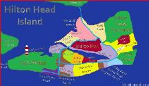
| Hilton Head Government map |
|
Shows the parks and public amenities all over Hilton Head Island |
| Interactive Map of Bluffton SC |
|
This interactive map shows all of the major neighborhoods and regional areas, color coded with pop up information boxes about each location |
| Interactive Map of Forest Beach / Coligny |
|
This interactive map shows all of the villa complexes, color coded with pop up information boxes about each location |
| Interactive Map of Hilton Head Island |
|
This interactive map shows all of the major neighborhoods and island areas, color coded with pop up information boxes about each location |
| Interactive Map of Hilton Head Plantation |
|
This interactive map shows all of the neighborhoods, color coded with pop up information boxes about each location |
| Interactive Map of Mid Island HIlton Head |
|
This interactive map shows all of the neighborhoods and villa complexes, color coded with pop up information boxes about each location |
| Interactive Map of Palmetto Dunes |
|
This interactive map shows all of the neighborhoods and villa complexes, color coded with pop up information boxes about each location |
| Interactive Map of Sea Pines |
|
This interactive map shows all of the villa complexes, color coded with pop up information boxes about each location |
| Interactive Map of Shipyard Plantation |
|
This interactive map shows all of the villa complexes, color coded with pop up information boxes about each location |
| Map of Hilton Head Island |
|
Showing plantations, major landmarks, parks, and major stores |
| MilebyMile |
|
A detailed route description of Highway 17 from Charleston to the SC/GA border |
| Palmetto Dunes |
|
Resort Map |

